US States that Are Least Likely to Survive a Zombie Apocalypse
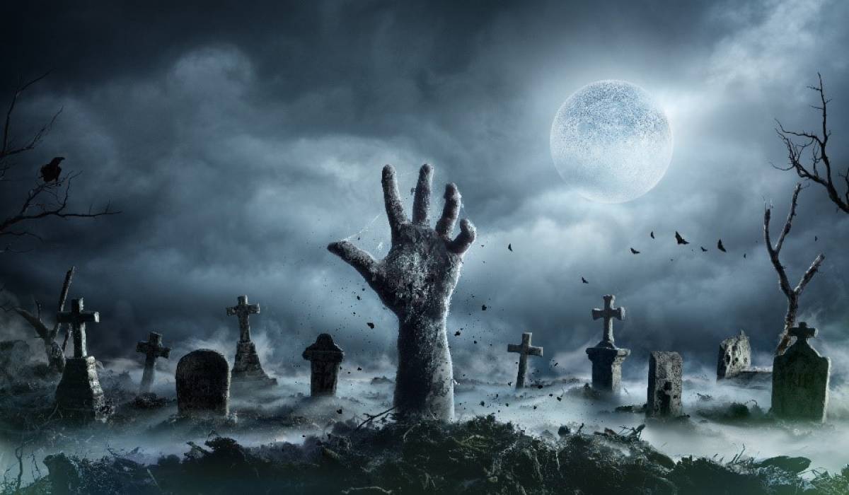
Image credit: Romolo Tavani/Shutterstock
TV shows like ‘The Walking Dead’ and ‘iZombie’ have shown us that although it’s unlikely, you should always consider the possibility of a zombie apocalypse.
On the off chance that doomsday is around the corner, experts at RantCasino sought to investigate which states of the US would be most affected by a zombie apocalypse.
Estimations for this study are based on a sample of 369,240 globally geolocated cemeteries and graves acquired from an established public database of cemetery records.
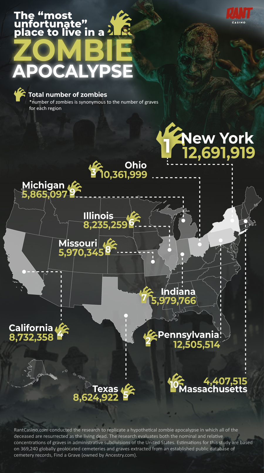
The total number of zombies is synonymous to the number of graves in the area.
The Results: Zombie apocalypse unfortunate states
With a whopping 12,691,919 potential living dead roaming the streets, New York is the worst US state to be in, should a zombie apocalypse occur. The Big Apple is also home to 9,730 cemeteries, which we recommend avoiding!
The second most dangerous state to live in during a zombie apocalypse is Pennsylvania, with 12,505,514 potential walking dead.
In third place is Ohio, with the chance to host 10,361,999 zombies during doomsday - 15% more walking dead than California which comes in fourth place with 8,732,358.
Texas comes in fifth place (8,624,922 potential zombies), followed by Illinois (8,235,259), Indiana (5,979,766) and Missouri (5,970,345).
There is a glimmer of hope for the states in ninth and tenth place, which are Michigan (5,865,097 potential zombies) and Massachusetts (4,407,515).
- If you live in New York, you might not escape unharmed in a zombie apocalypse - with a whopping 12,691,919 potential zombies roaming the streets.
- New York is also home to 9,730 cemeteries, which we recommend avoiding!
- The second most dangerous state to live in during a zombie apocalypse is Pennsylvania, with 12,505,514 potential zombies.
- If you live in Alaska you might escape a potential zombie apocalypse unharmed, with only 72,849 potential zombies roaming the streets.
States that would be the LEAST affected in a zombie apocalypse
Residents in Alaska might not notice there is a zombie apocalypse, with just 72,849 potential creatures roaming the streets during doomsday. The same can be said for Wyoming, the second least affected state, with only 295,117 potential zombies roaming the streets.
The third least dangerous place to live during a zombie apocalypse is Nevada (333,326 potential zombies), followed by Hawaii (343,193) and Delaware (446,313).
The researchers conducted the study to replicate a hypothetical zombie apocalypse in which the deceased are resurrected as the living dead. The research evaluates both the nominal and relative concentrations of zombies in administrative subdivisions of the United States and United Kingdom
Estimates for this study are based on a sample of 369,240 globally geolocated cemeteries and over 200 million registered graves acquired from an established public database of cemetery records, Find a Grave (owned by Ancestry.com).
Firstly, a custom web crawler was built to systemically and asynchronously locate all cemeteries on Find a Grave. Each cemetery’s metadata including the coordinates and the number of graves was scraped. Cemeteries without coordinates were omitted from our sample.
Subsequently, the sample of cemeteries was reverse-geocoded using the Ordnance Survey Administrative Boundaries and the Topologically Integrated Geographic Encoding and Referencing (TIGER) boundary lines for the UK and USA respectively.
Population estimates from the ONS and the NASA Socioeconomic Data and Applications Centre (SADAC) are used to define district and state level populations for the UK and USA respectively. Population estimates from the SADAC were polygonised from raster images and spatially joined to the TIGER state-level boundaries.
The geolocated dataset of cemeteries was then aggregated by district and state to determine the total number of cemeteries, the total number of graves, graves per capita (%) and graves per KM2 for each administrative subdivision to find the unluckiest places to live during a zombie apocalypse.


![[node:title]](/sites/default/files/styles/video_thumbnail_bottom/public/person%20outdoors%20activities%20musthaves%20standing%20on%20gray%20rock.jpeg?itok=oQDqT42h "7 Must-Haves for Hiking, Fishing, and Other Outdoor Activities")